
The Elios 3 surveying drone by Flyability is a big deal in aerial mapping and 3D data. It lets users make super accurate scans of hard-to-reach places. This drone breaks through old limits, giving a full view of tricky spaces.
It’s great for checking out complex places, surveying tough terrains, or mapping underground areas. The Elios 3 makes it safer and faster to get geospatial data. In this I’ll give the best review about Elios 3 Surveying Drone Cost.
Key Takeaways
- The Elios 3 Surveying Payload can navigate through openings as compact as 50x50cm, accessing previously inaccessible areas.
- The Ouster OS0-128 Rev 7 LiDAR sensor and FARO Connect SLAM algorithm create highly detailed 3D maps and digital twins with centimeter-level accuracy.
- The Elios 3 Surveying Payload boasts a remarkable point density of 1,310,720 pts/sec, extending scanning capability up to 100 meters.
- Mapping tasks that once took days can now be accomplished in just 10 minutes, significantly improving efficiency.
- The Elios 3’s patented flight controller and motor design ensure flight stability after collisions, navigating complex environments with ease.
Introduction to the Flyability Elios 3 Surveying Payload
The Flyability Elios 3 Surveying Payload is a new tech that lets pros get detailed scans in hard spots. It can go through openings as small as 50x50cm. This tech makes detailed digital twins and 3D maps, breaking through old limits.
Surveying the Inaccessible
Getting all the data is key for good decisions. The Elios 3 lets experts explore tough spots. It gives insights that old tools or other drones can’t.
Bridge Data Gaps in Challenging Environments
The Elios 3 can get detailed data in spots that were hard to reach. This helps many fields, like building and managing assets. It lets pros make better choices with a full view of their area.
| Key Specifications | Elios 3 Surveying Payload |
|---|---|
| Accuracy | 0.1% Global Accuracy |
| Precision | 6mm 1σ |
| Capture Rate | 1.3 million points per second |
| Range | 100m |
The Elios 3’s LiDAR scanner captures data like never before. It offers top accuracy, precision, and detail. This helps make better choices in many areas.
Survey-Grade Accuracy and Stunning Point Clouds
The Flyability Elios 3 Surveying Payload makes incredibly detailed 3D maps and digital twins. It has centimeter-level accuracy. This is thanks to the Ouster OS0-128 Rev 7 LiDAR sensor and the FARO Connect SLAM algorithm.
It can capture data with +/- 6 mm (1σ) and +/- 12 mm (2σ) precision. The LiDAR sensor scans up to 100 meters and 1.3 million points per second. This is great for indoor environments.
“The Elios 3 Surveying Payload’s ability to generate survey-grade 3D models of assets makes it an invaluable tool for surveyors, allowing them to effectively map inaccessible areas with unparalleled precision.”
The Elios 3 produces high-density point clouds. It has 1,310,720 points per second. These can be exported in LAZ, LAS, PLY, TXT, and E57 formats.
The Elios 3 has a modular payload bay. This makes adding the LiDAR sensor easy. The drone’s reversing motors and SLAM-based stabilization ensure stable data capture.
Uplifted Mapping Efficiency
The Flyability Elios 3 Surveying Payload changes how we map. It can go up to 100 meters and capture 1,310,720 points per second. It can even fly through a 300-meter tunnel in one go.
This drone mapping efficiency improvements make projects faster and more precise. Tasks that took days can now be done in just 10 minutes.
Scanning Beyond Safe Access
The Elios 3 is small and safe to fly in tight spots. It can get into places other tech can’t, making data collection safer and more detailed. It can even fit through openings as small as 50x50cm.
It’s very precise, with +/- 6 mm at 1σ and +/- 12 mm at 2σ. This means it can map areas with high accuracy.
Compared to old methods, the Elios 3 is way faster. It can map 100% of an area in 18 minutes. Old methods only cover 15% in the same time. It can also map a 300-meter tunnel in one flight, saving a lot of time.
| Metric | Elios 3 Surveying Payload | Terrestrial Scanning |
|---|---|---|
| Area Coverage in 18 minutes | 100% | 15% |
| Tunnel Coverage in a Single Flight | 300 meters | N/A |
| Precision (+/- mm at 1σ) | 6 | N/A |
| Precision (+/- mm at 2σ) | 12 | N/A |
| Scanning Rate (points/sec) | 1,310,720 | N/A |
| Range (meters) | 100 | N/A |
The Elios 3 comes with FARO Connect software. It has tools for aligning data, georeferencing, filtering points, and exporting files. This makes the Elios 3 even better for surveying.
Create Clean, Georeferenced Point Clouds Automatically
The Flyability Elios 3 Surveying Payload works with FARO Connect software. This software makes it easy to handle LiDAR data from the Elios 3. It uses a special SLAM algorithm to make accurate point clouds.
FARO Connect has tools for managing data and setting up SLAM. It also makes it easy to see the data. This makes the work of creating point clouds more efficient and precise.
“The new Surveying Payload enhances data quality achievable with a drone survey and supports the vision of routine drone inspections with limited hardware turnover,” said Adrien Briod, Chief Technical Officer of Flyability.
Users of the Elios 3 can make clean, georeferenced point clouds easily. The SLAM algorithm gives results that are very accurate. This is great for surveys and inspections.
Using the Elios 3 and FARO Connect software changes how professionals work. It makes handling tough environments easier and improves data capture and processing.
Remote Radiation Detection and Localization
The ELIOS 3 RAD Payload makes quick and accurate indoor surveys easy. It lets people avoid dangerous areas with radiation. This system uses advanced sensors and smart algorithms to find radiation sources fast.
This means less time to make an area safe. It also keeps people from getting hurt by radiation.
Gain a Comprehensive Understanding of Radiological Situations
The ELIOS 3 RAD Payload is easy to launch. It helps users understand radiation levels safely. This tool lets teams quickly check and analyze radiation data.
This helps them make fast, safe decisions. It also improves safety plans without delay.
Identify, Locate, and Monitor Radiological Dose Fields
The Elios 3 drone is the first to do indoor radiation surveys. It shows radiation data on a 3D map of the area. This includes the drone’s path, radiation levels, and dose rates.
It was tested at nuclear sites in the U.S. and Europe. Experts from Radiological Protection Specialists and UAS Program Managers did the testing.
The ELIOS 3 RAD Payload gives real-time radiation readings. It shows current and total dose rates, max values, and history. It’s more than just an airborne dosimeter.
It maps and analyzes radiation conditions. This helps organizations track and check radiation levels. They can find radiation hot spots and check ambient levels.
Empower Dose Planning and Decision-Making

The ELIOS 3 RAD Payload is a top-notch tool for checking radiation exposure and improving safety. It gives detailed radiation data. This helps people make smart choices to lower risk and boost safety.
With the Mirion RDS-32™ radiation survey meter, the ELIOS 3 drone can map areas and gather 3D data on radiation. This radiation exposure assessment is key for setting up preemptive safety strategies and personnel dose optimization.
The ELIOS 3 gives real-time radiation readings and dose info. It maps dose fields in detail. This radiation safety data-driven approach makes safety plans fit the work area. It keeps people safe and boosts work efficiency.
“The partnership between Flyability and Mirion Technologies is aimed at enhancing safety in nuclear facilities through robotics.”
Using the ELIOS 3 RAD Payload, groups can understand radiation situations better. They can spot risky spots and take steps to reduce exposure. This leads to better dose planning and smarter choices, raising safety and work efficiency.
Reach Higher Safety Standards
The Elios 3 RAD Payload’s ability to measure total dose helps companies check their radiation safety plans. This lets them see how well their personnel dose exposure monitoring is working. They can then make changes to improve their radiation safety, keeping everyone safe and healthy.
The Elios 3 RAD Payload has advanced sensors that give detailed radiation readings in flight. This helps companies make smart choices to keep their workers safe. By using this technology, they can set higher safety goals and keep their team safe.
“The Elios 3 RAD Payload’s cumulative dose measurement capabilities allow us to quantify the effectiveness of our radiation safety protocols, enabling us to continuously improve and enhance the protection of our personnel.”
The Elios 3 RAD Payload works well with Mirion Technologies’ top radiation detection tools. This means companies get the best data to improve their radiation safety protocols optimization and personnel dose exposure monitoring. This partnership helps companies stay at the top of radiation safety, keeping everyone safe.
Key Features of the Elios 3 RAD Payload
The Elios 3 RAD Payload is more than just an airborne dosimeter. It offers detailed in-flight radiation measurement. You get instant access to current and total radiation dose rates. It also shows the highest dose recorded and a full history of measurements.
This data helps spot trends and understand radiation conditions better. It guides effective ways to lower exposure risks.
Comprehensive In-Flight Radiation Reading
The Elios 3 RAD Payload gives users accurate, real-time radiation data during flights. It collects and analyzes radiation measurements in flight. This way, users get a full picture of radiation dose rates and trends in the area.
Powered by Mirion Technologies
The Elios 3 RAD Payload is made with Mirion Technologies, a top name in radiation detection. It uses Mirion’s advanced tech for reliable and precise data. This data ranges from microsieverts per hour (µSv/h) to sieverts per hour (Sv/h).
Detachable and Swappable Sensor
The Elios 3 RAD Payload works well with any RDS-32™ WR sensor. This makes swapping and replacing sensors easy. It keeps the equipment in top shape and follows industry rules, all while keeping operations running smoothly.
This design makes managing sensor upkeep simple. It boosts efficiency and keeps safety and accuracy high in radiation surveys.
| Feature | Benefit |
|---|---|
| Comprehensive In-Flight Radiation Measurement | Gain real-time insights into radiation levels and dose rate trends |
| Mirion Technologies Powered Sensor | Ensure trustworthy and precise radiation data for critical decision-making |
| Detachable and Swappable Sensor | Streamline sensor management and maintain operational continuity |
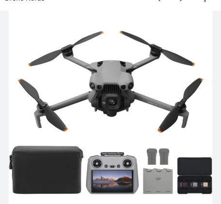
elios 3 surveying drone cost : Pricing and Procurement
The Flyability Elios 3 Surveying Payload is a big deal in aerial mapping and 3D data. It includes the Elios 3 drone, Ouster OS0-128 Rev 7 LiDAR, and FARO Connect software. This combo is top-notch for getting detailed data in tough spots.
Prices can change based on what you need and where you buy it. But the Elios 3 offers great benefits. It uses the latest LiDAR tech and is super agile and tough. This means better work for your team in surveying and mapping.
| Drone Type | Price Range |
|---|---|
| Consumer Drones | £50 to £1,000 |
| Photography and Videography Drones | £600 to £2,500 |
| Inspection Drones | £5,000 to £20,000+ |
| Surveying and Mapping Drones | £4,000 to £20,000+ |
| Agricultural Drones | £5,000 to £20,000+ |
Thinking about the Elios 3’s cost isn’t just about the drone. You also need to think about extras like batteries and software. This helps you plan your budget better. It makes sure you know what you’re getting into with your commercial UAV investment considerations and aerial mapping drone procurement.
The Elios 3 is a big investment, but it’s worth it for those who need top-notch surveying and data. It uses the latest tech and is super agile. This means better work for your team and a good return on your elios 3 surveying drone pricing investment.
Why Choose Us for Your Elios 3 Surveying Drone Needs?
We are an authorized reseller of the Flyability Elios 3 Surveying Payload. We aim to give you the best drone tech for surveying and data needs. Our deep knowledge of the Elios 3 and field experience help us guide you. We ensure easy integration, training, and support to get the most from this solution.
As a flyability authorized reseller, we offer top elios 3 surveying drone expertise. Our team knows the Elios 3 well. This means you get the help you need to use this reliable drone technology provider effectively.
Choosing us means getting unmatched service and support. We offer comprehensive drone surveying solutions made just for you. From start to finish, we’re here to help your team use the Elios 3 to its fullest. We aim to help you reach your surveying and data goals with confidence.
“The Elios 3 has been a game-changer for our surveying operations. The team at [Company Name] has been instrumental in helping us maximize the use of this innovative technology, providing exceptional support and training every step of the way.”
See why working with a trusted flyability authorized reseller is a smart choice for your Elios 3 needs. Reach out to us to learn more about our elios 3 surveying drone expertise. We’re ready to help your team achieve its surveying and data goals with the Elios 3.
| Key Capabilities | Benefits |
|---|---|
| Collision-tolerant design | Access hard-to-reach areas safely |
| High-quality LiDAR scanning | Capture detailed 3D point clouds |
| Intuitive flight controls | Simplified operation for non-pilots |
| Weatherproof construction | Operate in challenging environments |
Conclusion
The Flyability Elios 3 Surveying Payload is a big step forward in aerial mapping and 3D data. It lets users reach places they couldn’t before. This means they can make very detailed scans and understand complex areas better.
The Elios 3 RAD Payload also helps keep people safe in dangerous places. It finds and shows where radiation is, helping to keep everyone safe. We are dedicated to helping our clients use the Elios 3 to its fullest. This way, they can work more efficiently and safely.
The Elios 3 Surveying Drone does more than just map. It helps in mining, oil and gas, power, public safety, and more. It’s a game-changer for many industries. By using it, our clients can work better, take fewer risks, and make smarter choices. This helps them succeed in today’s fast-changing world.
FAQ
What are the key features and capabilities of the Flyability Elios 3 Surveying Payload?
The Flyability Elios 3 Surveying Payload has many advanced features. It can access and capture high-resolution scans in places other tech can’t. It uses the Ouster OS0-128 Rev 7 LiDAR sensor and the FARO Connect SLAM algorithm for accuracy.
It can scan up to 100 meters away and has a point density of 1,310,720 points per second. It can even navigate a 300-meter tunnel in one flight. Plus, it works well with the FARO Connect software for easy data management.
How does the Elios 3 Surveying Payload improve surveying and data collection efficiency?
The Elios 3 Surveying Payload makes surveying and data collection much better. It lets us explore and analyze hard-to-reach areas. This gives us a deeper understanding of complex environments.
It also makes mapping tasks much faster. Instead of taking days, it can be done in just 10 minutes. It can also create detailed digital twins and 3D maps in places we can’t see.
What are the key features and capabilities of the Elios 3 RAD Payload for radiation detection and localization?
The Elios 3 RAD Payload is great for detecting and localizing radiation. It measures radiation in flight, including current and cumulative dose rates. It works well with Mirion Technologies’ RDS-32™ WR sensor for accurate data.
It helps find and monitor radiation fields safely. This means we don’t have to be in dangerous areas. It also helps us understand radiation exposure and keep people safe.
How does the Elios 3 RAD Payload enhance radiation safety protocols?
The Elios 3 RAD Payload makes radiation safety better in many ways. It gives us detailed data on radiation conditions. This helps us make safer decisions and take safety steps early.
It also helps us see how much radiation people are exposed to over time. This shows if our safety measures are working. It uses top technology from Mirion Technologies for the most accurate data. This helps keep our workplace safe.
What is the cost of the Flyability Elios 3 Surveying Payload?
The cost of the Flyability Elios 3 Surveying Payload can vary. It depends on what you need and where you buy it. As an authorized reseller, we offer clear and competitive prices.
We make sure you get the best deal. We also provide the support you need to get the most out of this innovative solution.